

In central Namibia, our team from the Leibniz-IZW investigated the spatial behaviour of male cheetahs using high-resolution, long-term movement data and identified communication hubs as hotspots of cheetah activity.
Our findings help to reduce conflict between cheetahs and farmers by providing key information for succesful herd management. If we are able to validate this knowledge and experience in different contexts, we could potentially upscale a promising conservation solution to the entire range of the cheetah. We teamed up with WWF Germany to do exactly that!

As a first step, we want to understand cheetah spatial behavior in other parts of the range. If we find the same pattern in other parts of the range, we strongly believe it could help the mitigation of potential cheetah human conflict once adapted to the local characteristics. We see this as a scientific exercise with the aim of evidence based conservation e.g. to further improve local mitigation solutions.
Do you have cheetah data and want to be part of a large collaborative metastudy on cheetahs? Then please join the community! We would love to collaborate with you and learn so much more about this interesting species together!
Background
Since 2001, we have been investigating the spatial ecology of free-ranging cheetah males, among other topics. For this we use high-resolution GPS movement data collected within the frame of our long-term study. Our two main findings regarding the spatial ecology are:
a) We described two spatial tactics of cheetah males in Namibia, similar to findings in the Serengeti National Park in Tanzania. Males either defend small territories (territory holders) or roam in large home ranges, encompassing 2 to 4 territories (floaters). Females also have large ranges, overlapping with male territories and floater home ranges. We also identified several predictors linked to the spatial tactics of cheetah males. These predictors are marking behavior, aggressive behavior in traps and high body mass index of territory holders compared to floaters. This study was published in Ecosphere and can be downloaded here.
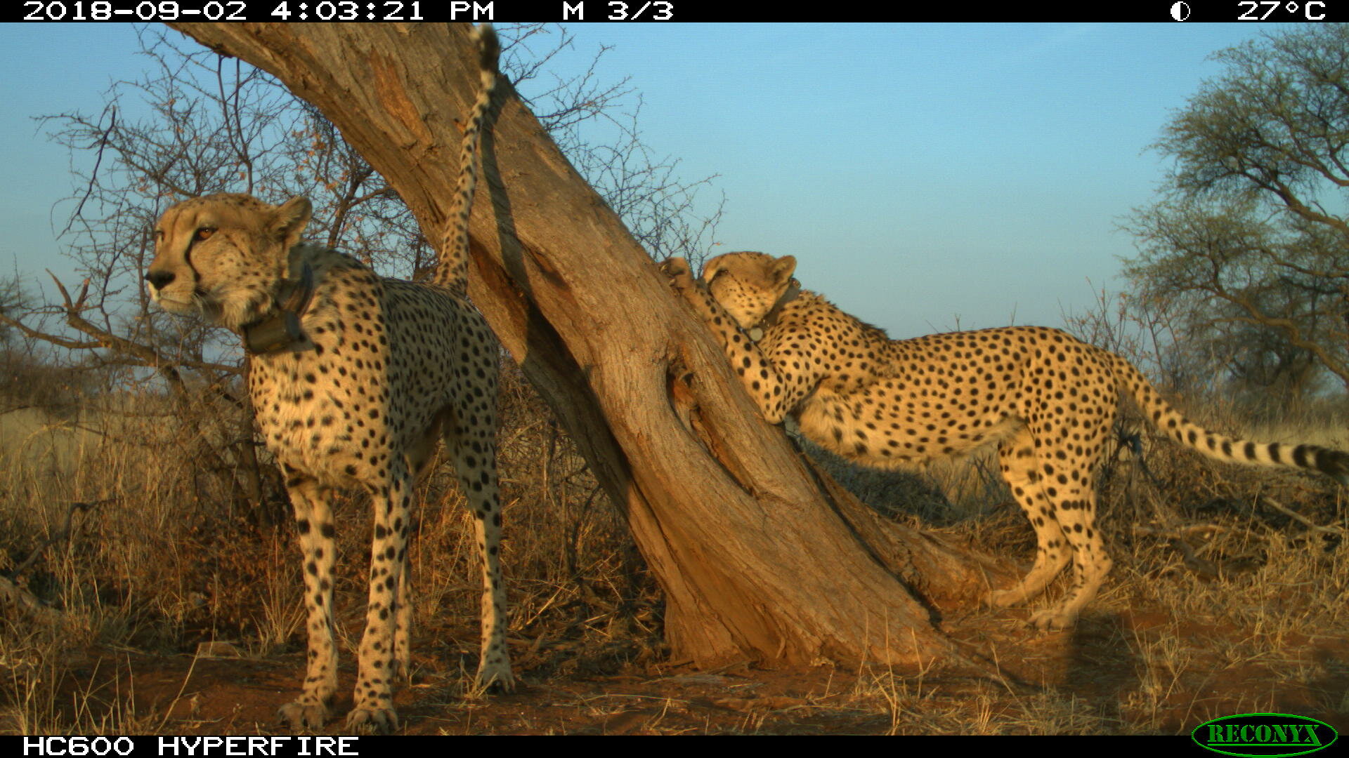
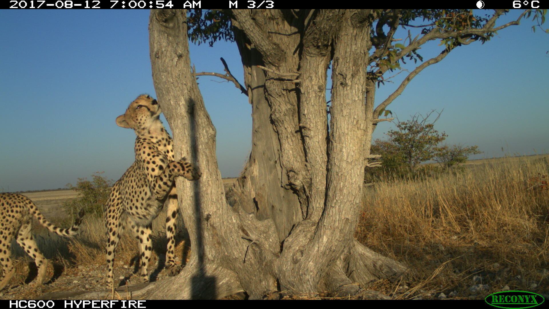
b) We further identified “hotspots”, i.e. areas of high cheetah activity, which are distributed in a regular pattern across the landscape with an average distance of 23 km between them. Hotspots represent clusters of marking sites such as conspicuous trees, rocks and termite mounts and are frequently marked with urine and feces by territorial cheetah males. They are also visited by floaters and females and used by all cheetahs to receive and/or leave information. The locations of hotspots remain constant over time. We termed the hotspots “communication hubs” due to their function within the cheetah population.
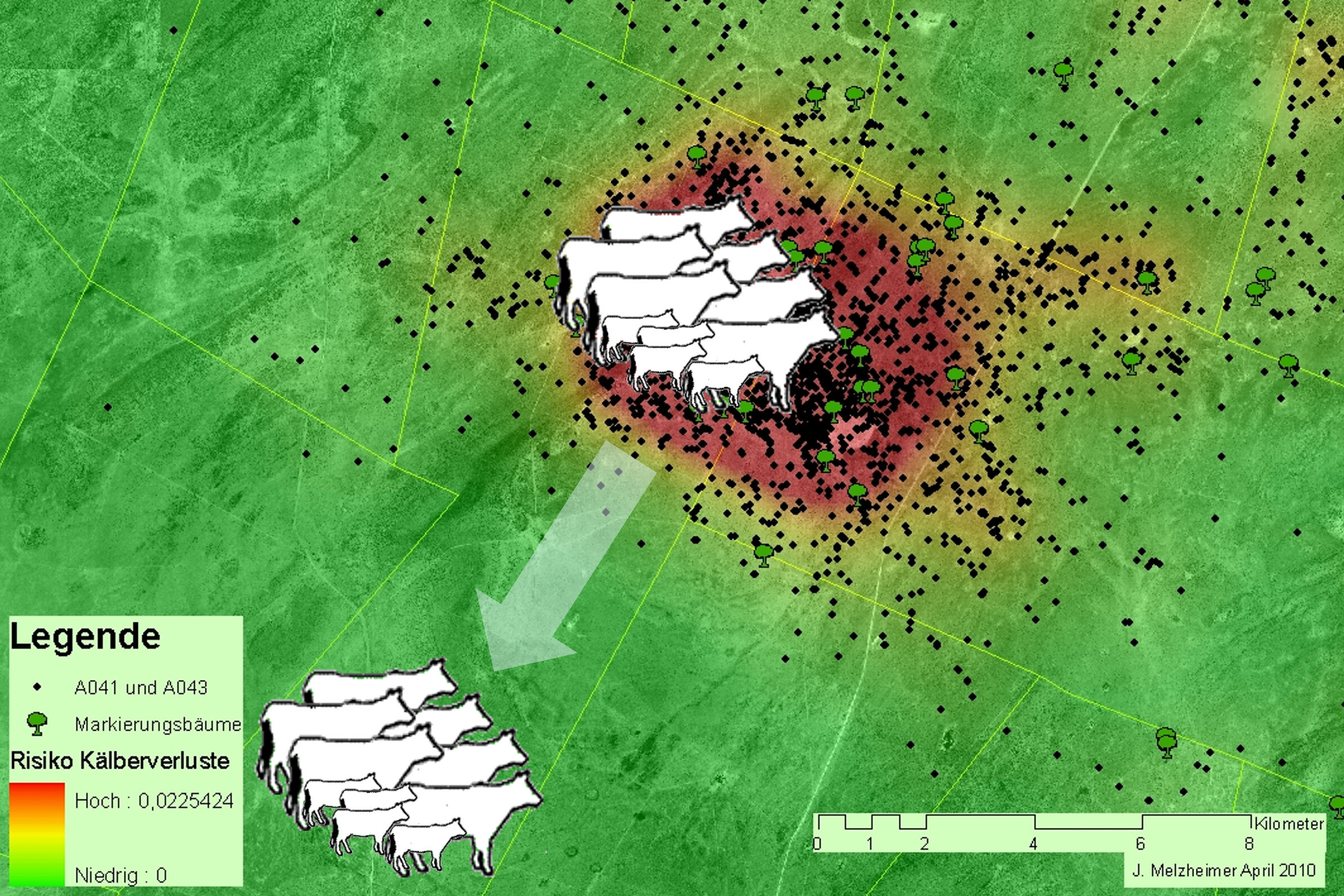
The existence and the regular pattern of these communication hubs results in an inhomogeneous distribution of cheetahs in the landscape. This knowledge is crucial to plan research such as camera trap studies. It has also important implications for the conflict between farmers and cheetahs in Namibia because identifying the location of the communication hubs provides vital information to the farmers to adapt their herd management accordingly. In our study area, an adaptive management of cattle herds reduced the livestock losses by 86% on avarage. This suggests that efforts of conflict mitigation should include the spatial organization of cheetahs on a landscape level. This study was published in Proceedings of the National Academy of Sciences of the USA (PNAS) can be downloaded here.
Upscaling our previous work across the cheetah range
The socio-spatial organization of a species has evolved under selection pressure and thus should be relatively constant across its distribution. We assume that the spatial movement patterns of cheetahs described above can also be found in other ecosystems. The details of the movement patterns might differ locally, such as sizes of territories and home ranges, but generally we hypothesize:
Hyp 1: male cheetahs operate in two spatial tactics (territory holders and floaters) in all ecosystems, irrespective of males being solitary or in coalition unitsHyp 2: cheetahs have communication hubs in the core areas of the territories in all ecosystemsHyp 3: territories are not adjacent to each other but are separated by a surrounding matrix in all ecosystemsTo investigate these hypotheses, we would like to examine existing data within the community of researchers involved in cheetah projects. For this, we are aiming to establish a collaborative network and collate cheetah data collected across different habitats and countries. The data needed for this planned study include GPS locations of collared cheetahs and other data such as direct cheetah observations, camera trap pictures and marking locations.
Set up a scientific network and data sharing platform
With this study, we also aim to build up an open scientific network that promotes collaborative science-based knowledge and data sharing to investigate cheetah spatial ecology. As a first step, we suggest storing the cheetah spatial data in the online platform Movebank, a global archive for animal movement and bio-logging data. For those not familiar with Movebank, here is a short list with general information:
You decide who to grant full access to your data
You retain full ownership of your data
Your study and some basic information (e.g. study species, study location, PI, number of animals, but not the GPS data) becomes visible and detectable for potential collaborators
Your data are preserved in a large, safe repository
Your data are structured and neatly organized
Your data are automatically prepared for R and GIS software
You can share your data very easily and quickly with potential collaborators
We are happy to answer any questions you might have to help getting your project into Movebank. We are also happy to upload your data for you into an individual Movebank project that will be handed over to and owned by you.
If you like to participate in this metastudy but do not wish to have your data stored in Movebank, you can still contact us and we look for individual solutions.
How to participate and be part of this metastudy?
Please fill in our Google form containing questions on the data you would like to provide for this study.
We will contact you personally to discuss your participation and the best way for you to securely share your data with us.
Please download, sign and send the data sharing agreement together with your data.
If further information is needed, please contact us: radford@izw-berlin.de
